Dutch Dikes protect a country up to 22 ft below sea level. The Waterworks form an insane number of hot spots you must have seen. But don’t just focus on the gigantic dams within the Dutch Delta Works. Also, think of canoe trips on lakes and through polders. Cycle trips along Mounds; on Dikes; along the large Rivers or undertake sailing trips on Frisian lakes, the Ijsselmeer and the Wadden Sea.

Half of the Netherlands is underwater without the Dutch Dikes
More than half of the Netherlands will be under water if the Dutch do not protect their country from the sea and the major rivers. When the Romans sailed down the Rhine in their flat-bottomed barges 2000 years ago, they initially did not go further than Utrecht. They ignored the impenetrable marshes at the mouths of the major rivers where the tides had free rein. Life around the misty marshes in the delta, where clouds of mosquitoes swarm in the summer, did not appeal to the Romans.


First mounds, then dikes, and subsequently polders in swamps
Long before the arrival of the Romans, the Dutch ancestors built mounds. This is how mound villages came into being. The city of Leeuwarden, for example, was built on three mounds. The villagers worked the land around the mounds. To safeguard their cattle and crops, people living on mounds built the first dikes 1700 years ago. As time passed, lakes, whose eroding banks threatened cities such as Amsterdam, were drained. This is how the polders Haarlemmermeer, Schermer, and Beemster came into being. The battle against the water is an ongoing one. The Delta Works are barely completed in 2025 when the standards for dikes and dunes are adjusted upwards. The Netherlands prepares for climate change. At the beginning of the 21st century, the Dutch see themselves confronted with a daunting challenge, as storms become more severe and sea levels rise substantially. The Dutch, fundamentally threatened in their existence, face a mind-bending political choice at the beginning of the 21st century: or (1) invest fully in protection against rising sea levels and unleashed rivers, or (2) join the arms race as the 21st century descends into devastating military operations.


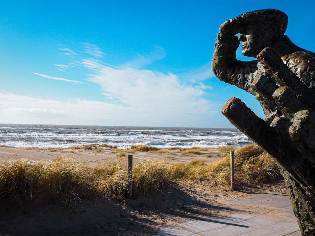
Villages built on terps in a flooded land
Frisian and Groningen terps are elevations in the landscape that were once constructed to protect people from flood waves when there were no dikes yet. The first Dutch Dikes were constructed in the 13th century. But long before the beginning of our era, people were already living on mounds in the salt marshes along the north coast. Traces of the former mounds can be found in the current landscape. On the 45 km long track called “Terpenlandroute” around Dokkum, Hegebeintum is located on a mound that already inhabited 2600 years ago, once almost 10 hectares in size and now still 8.80 meters high. The Groningen village of Tinallinge was built on a mound 6 hectares and 3.7 meters high. Don’t forget to walk the oxengang around this mound, which is virtually intact. The radial structure of the mound construction in nearby Middelstum and Niehove is authentic. Niehove is not to be missed.

Opening the Dutch Dikes: winning Wars with Water
The Netherlands fights against the water, and the water fights for the Netherlands. How water protects the Netherlands tells the story of the Dutch Waterline. An 85 kilometre-long defense line with 45 forts, 6 fortresses, and 2 castles aimed at preventing infantry movements towards Amsterdam, Utrecht, and Haarlem by flooding the country. Now we are talking about the largest national monument in the Netherlands. A monument of such historical value that it has been registered as a UNESCO World Heritage Site. The Dutch Waterline runs from the island of Pampus in Amsterdam to the Biesbosch. The Waterline nowadays houses campsites, restaurants, breweries, and a colorful collection of businesses. Walking, cycling, and sailing routes connect the various elements of the Waterline. Enjoy a breath of fresh air on your bike. Pedal through an emerald green polder landscape. Paddle your canoe from one fort to the next. And after all that effort, reward yourself in a renowned restaurant in one of the fortified towns.

Loving Holland is loving Dutch Dikes
There are 17,500 km of Dutch Dikes in the Netherlands. Among which there are dozens of different types of dikes being part of different dike systems. If you fall in love with the Netherlands, you cannot avoid a close relationship with dikes. And dikes are extremely popular. Especially with cyclists and motorcyclists. Residents of dike houses along the major rivers sometimes experience this love as a nuisance. In the river country, between the German border and Werkendam, there are already more than 500 km of dikes along the Rhine, Waal, Maas and Linge. Riding over meters-high river dikes, on the one hand you look at the floodplains and on the other hand you look out over an endless polder landscape. And the great thing is that almost all of these Dutch Dikes are accessible to traffic. Cycling from Den Bosch to Utrecht, you prefer to follow river dikes and take ferries to get from one river to the other. And if you are on foot, you can follow clog paths through the floodplains. These bring you closest to beaches along sometimes dangerously flowing rivers.

How dunes replace Dutch Dikes
Where, until 2014, one of the heaviest dikes in the Netherlands was located, you now find dunes. Where basalt blocks, concrete, and asphalt protected the hinterland from the sea, the stones are now covered with sand. Where beach grass flourishes and dune sand blows in the wind. In a short time, sand dredgers have created a 300-meter-wide sandy beach with a lagoon at Petten and Callantsoog. An ideal place for a day at the beach and a walk along the Coastal Path. Do you want to know how far the sea would come if the sea broke through the sea wall here? Then follow the 40 km long cycle route over the Dutch dikes from Petten, via Camperduin, Bergen, Krabbendam, and Eenigenburg back to Petten.


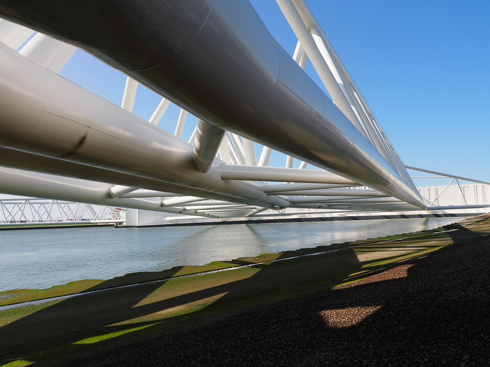
Maasvlakte: Port of Rotterdam continues to grow into the sea.
Rotterdam is one of the largest ports in the world. The port has now outgrown itself to such an extent that expansion inland is no longer possible. So the port continues to grow into the sea on the Maasvlakte. The Dutch built dikes and filled the space between the dikes with sand with their immense sand suction dredgers, creating immense artificial islands in the sea. The most advanced container terminals in the world are located here. Liquid nitrogen is stored where the sea had free rein a few years ago. Take a ferry from Hoek van Holland to the Maasvlakte or get there by bike or car. Do visit the information center and the museum “Futureland”. Take a boat trip at the Museum Harbor. Do a hike or bike along the Dutch Dikes. Discover how nature develops. Sail along the main ports and wander over endless beaches along the mouth of the River Rhine. You will see that the restless wind is creating dunes on newly constructed dikes. On the Maasvlakte, Dutch Dikes are drowning in the sand.


The Delta Works was once seen as final solution to stop flooding
In 1953, the southwest of the Netherlands was hit by an unparalleled flood disaster. No fewer than 1,836 people drowned when the Zeeland dikes gave way under the force of a storm surge combined with a spring tide. To prevent such a disaster in the future, the Delta Works were started in the mid-1950s. The Delta Works are about the closure of the sea arms in the southwest of the Netherlands. Nowadays, almost all the sea arms between the islands are closed, and the islands are connected by dams. You should follow (part of) the 457 km long Delta route by car or bicycle, crossing the Oosterscheldekering, the Brouwersdam, and the Haringvlietdam. Next, you cross the Maasvlakte and arrive at the Maeslantkering. Finally, via the Biesbosch, you return to the Zeeland countryside with its endless beaches, unparalleled nature, and the highest dunes in the Netherlands at Burgh-Haamstede.

Largest storm flood barrier in the world: Oosterscheldekering
After 10 years of construction, the Dutch Queen Beatrix opened the Oosterscheldekering in 1986. Worldwide, millions of people watch the putting into operation of the largest storm surge barrier ever on TV. The dam is 9 km long and protects the hinterland against tidal waves that statistically occur at most once every four thousand years. To understand the colossal efforts the Netherlands has made to protect its country against the water, you have to see the Oosterscheldekering. Just follow the N57, this road runs over the Oosterscheldekering. Halfway along the Dam on the former work island Neeltje Jans, you will find a visitors center, the Delta Park, a kite surfing school, a nudist beach, and hotels and restaurants. Just north of the dam are the most beautiful beaches in the Netherlands on the island of Schouwen-Duiveland.


A storm Surge Barrier to keep 1.2 million people’s feet dry
The Maeslantkering is the storm surge barrier that keeps Rotterdam dry. This movable dam is crucial for the protection of 2 million people. When a devastating storm swells and the sea rises to extreme heights, you want to be at the Maeslantkering. Then it is the best place to see how the Netherlands fights its battle against the water. Doors meeting a total length of 420 meters automatically close the mouth of the Harbor of Rotterdam as soon as a storm surge threatens. The structure is immense, guarantees safety to the people of Rotterdam, and is also impressive to see when the doors do not close. The Maeslandkering is designed to stop a storm surge of 5 m above sea level. The water barrier closes automatically at a water level of 3 m above sea level and is the largest in the world. The doors are 22 m high and 15 m deep. The ball hinges have a diameter of 10 meters. Every year during the first or second weekend in September, the Maeslandkering is tested utilizing a “functioning closure”. Then you also want to be there. The information center “Keringshuis” is open daily. Book a tour and enjoy apple pie in the restaurant.
For 700 years, people wanted to build this Dutch Dike
For hundreds of years, gigantic floods have plagued the lowlands around the Zuiderzee when north-westerly storms push the water level up. People drown, harvests fail, and cattle die in a salty sea. By the 12th century, people were completely fed up with it. Back then, there were already plans to close off the Zuiderzee. But the people had to wait 700 years until 1932, when a dike more impressive than the Great Wall of China finally kept the sea out. This Dutch Dike, 32 km long, is visible on satellite images. The A7 runs over it, and the 785 km long cycle route “UNESCO World Heritage Netherlands” follows the Afsluitdijk.
On the Afsluitdijk near Kornwerderzand, you will find the Kazematten museum, a visitors center with an excellent restaurant and a museum about the engineering of the dike. In the middle of the Afsluitdijk, where the last gap in the dike has been closed, you can have a picnic and visit the lookout tower. At the beginning and end of the dike at the Lorentz locks and the Stevin locks, Studio Daan Roosegaarde accentuates the lock towers built in Art Deco style with reflective lines.


The lowest point in the Netherlands is 6.76 meter below sea level
The lowest point in the Netherlands is located in the deepest polder in Europe. You will find, along the highway in the city of “Nieuwerkerk aan de IJssel”, a monument at a point 6.76 meters below sea level. If you dream of the Netherlands, you want to have been to this place, though it is quite a boring spot, in the Zuidplaspolder. But it is very nice to bike to the monument. From the historic city center of Gouda, you can cycle to the lowest point in the Netherlands in half an hour. Once comfortably in the saddle, follow the “Fietsroute Zuidplas” through an impressive Dutch landscape. You cycle along the river Rotte over the dike, passing mills, pumping stations, and locks.


Leave A Reply